


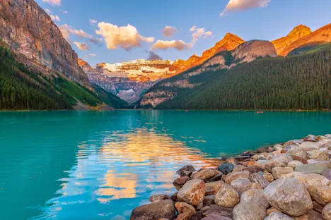


Many travelers put Iceland on their bucket list to experience the northern lights or the midnight sun. But that is not the only spectacular show of nature that Iceland provides. This island, the second largest in Europe, is right where the North American and Eurasian plate boundaries meet. The underlying geothermal forces create a stunning and diverse landscape. Visitors can discover vast lava fields, massive glaciers and explosive geysers, endless hot springs and towering waterfalls, dramatic basalt pillars and moody black sand beaches. While a lot of travelers unfortunately never get past the cozy capital Reykjavik—population a mere 300,000—and its famous Blue Lagoon, Iceland is a compelling destination for nature lovers who want to get to know its unique geological features by land, air and sea. Only about a quarter of the island is inhabited, but more can be explored with an educated and trustworthy adventure guide.
But how did this intriguing island that is thought to have been completely uninhabited until it was settled by Norse Vikings in the 9th century come to be? Some geologists think that Iceland started its formation about 60 million years ago when the Mid-Atlantic Ridge started to first give way. Iceland’s main formation period from there is often split into three parts. The first and oldest is the Tertiary Granite formation which took place between 16 to 18 million years ago. The oldest rock you can still see today in Iceland above sea level is 16 million years old, as the older rocks have fallen into the sea. Iceland’s location smack in the center of the Mid-Atlantic Ridge comes with inherent movement that causes an opportunity for the magma that resides underneath to rise. This magma upwelling is called the Icelandic Plume and when it first rose from the sea, it hardened to create the very initial parts of Iceland. You can see these areas firsthand in the Westfjords. The sheer isolation of the Westfjords region has kept it off the traditional tourist circuit (although Nat Hab offers an itinerary where guests can traverse it in depth).
The second formation period happened during an ice age that took place about 3 million years ago. The magma from volcanic eruptions from beneath the ice burned holes through the ice and opened space for forcing out sand, glass and water in a violent and explosive manner. These materials reacted over the years to form a palagonite (also called a palagonite tuff or volcanic tuff). We have this period to thank for forming the tuff mountains and cliffs that we can still enjoy today. Well-known tuff mountains in Iceland are the Blue Mountains near Reykjavik, Valahnukur inside Thorsmork and Reynisfjall at Reynisfjara Black Sand Beach. The beautiful valleys in Iceland were formed during the last ice age when glaciers cut through rock formations, gouging deep into the underlying bedrock. When rising sea levels filled some of the long, narrow valleys formed during this process, they created a series of fjords along the coast, which are particularly prevalent in the northwest of the country.

The Herdubreid Mountain, considered by many to be the most beautiful mountain in Iceland, is a table mountain in the central highlands near the Askja volcano that was created between the second and third formation stages. It was formed about 20,000 years ago. Nicknamed the ‘Queen of Icelandic Mountains’, it was formed when magma that erupted through the ice ran off atop the glacier. This region is very unique in its landscape—because of its bareness, NASA used the Askja caldera, formed when the volcano erupted in 1875, as a training center for a lunar expedition about fifty years ago. Very lucky travelers to Iceland can explore the Askja caldera by Super Jeep, a large SUV that has been modified with big tires and extra shock absorption to provide a more comfortable ride over the off-road terrain. Lake Askja, which fills part of the depression, is one of the deepest lakes in Iceland at nearly 700 feet.
The final formation stage began when the ice started melting about 10,000 years ago and the “modern lava” started flowing. This created lava fields like the ones found in Thingvellir National Park and the lava field surrounding the Langjokull glacier.

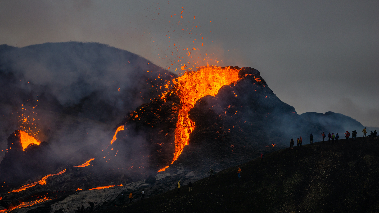
Iceland today is home to about 130 volcanoes (roughly 30 are considered active) and there is usually an eruption every decade or half-decade. Approximately a third of the basaltic lava that has erupted in recorded history (since around 1500 AD) has been produced by Icelandic eruptions. The major constituents of the magma from the volcano eruptions are tephra and basalt lava—giving us places like the basalt seas stacks called Reynisdrangar Rocks. Based on the age of the rocks formed from basaltic lava, the island can be divided into 3 regions: Quaternary flood basalts, Tertiary flood basalts and fissure swarm. Quaternary flood basalts are predominant in the southwestern, eastern and central parts of Iceland. Fissure swarms make up about 30% of Iceland and the tertiary flood basalts cover most of the Northwestern region of the country.
Iceland is a fascinating land of constant change. Just a few decades back in 1963-67, the ever-evolving geology resulted in the creation of a brand new island, formed right off Iceland’s southern coast. The island, called Surtsey, is one of the best researched newly-formed islands in the world. Visitors with an interest in understanding more about Iceland’s dynamic geology should plan a stop at the Lava Center, which offers an interactive exhibition about the natural forces that have shaped the landscape throughout Iceland’s history.

For those still somehow not convinced that Iceland has some of the most awe-inspiring geology on the planet, or for those who want to learn a bit more, we encourage you to check out this video by Stefan Forster. It is organized into three parts: Moss, Sand and Rocks; Glacier and Ice; and Water and Coast. It’s pretty much guaranteed that after watching it, you’ll want to book your own expedition to this compelling island filled with wonder.


