
Greenland Ice Sheet Melt Exceeds Scientific Predictions

Greenland has become the global symbol of climate change. From polar bears stranded on flimsy floating ice slabs to shocking time lapse photos of glaciers melting to “before”/”after” images showing rapidly receding glacial lines.
Recently, scientists have been able to quantify just how dire Greenland’s climate change situation is. By using advanced satellite technology, researchers discovered that the Greenland ice sheet lost a staggering 1 trillion tons of ice from 2011 to 2014. The region has been at the forefront of climate science focus because of its potentially huge contributions to future sea-level rise, opens in new tab, which could be around 20 feet if the entire Greenland ice sheet were to melt.
Measuring ice sheet melt is critical, as it indicates the rate of climate change directly related to sea level rise. While melting sea ice is also problematic—you’ve probably seen the countless photos of polar bears standing on meager chunks of sea ice—it doesn’t have as great of potential to raise ocean levels because its mass is already in ocean waters. Sheet ice loss, on the other hand, has a greater potential to contribute to rising ocean levels because the once-frozen water runs directly into the oceans.
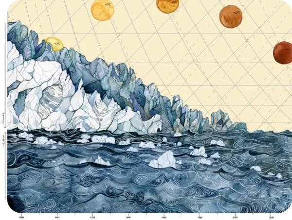
With data from the Cryosat-2 satellite, scientists were able to track sheet ice melt using a technique called radar altimetry. This technology can track the elevation of ice sheets and determine whether the heights are decreasing as the ice layers melt and thin.
Lead researcher Malcom McMillan noted, opens in new tab, “These observations reveal not only the extent of Greenland’s contribution to sea level in recent years… but we are able to identify the key glaciers that are showing the greatest signs of change. Satellite records are crucial for systematically monitoring our climate system, and assessing the impact of rising temperatures across Earth’s polar regions. They help us to understand the sensitivity of the ice sheet to changes in its surrounding atmosphere and ocean environment, and aid the development of reliable sea level rise projects.”
Climate change studies like these, opens in new tab that focus on trend analyses over time are few but critical because they can indicate how the Greenland ice sheet is responding to ongoing climate change. While it has already been widely noted that there has been massive glacier melt, McMillan made the point that this research reinforces just how disproportionate the ice sheet’s contribution is to sea level rise.
If Greenland’s sheet ice continues to melt at this accelerated rate, it could mean a larger future contribution to global sea level rise. It is clear that the Greenland ice sheet is in a fragile condition and the rate of climate change is looking precarious.
This post was written by guest contributor Maia Wikler, a Colorado College graduate with a passion for anthropology, human rights, travel and conservation. When she isn’t writing or reading, Maia loves to be active outside and planning her next adventure.