
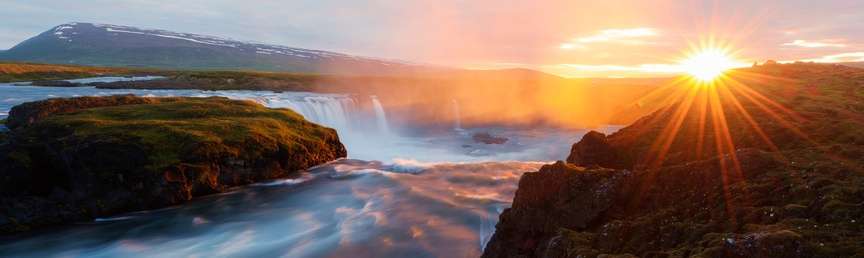
Two billion years of the Earth’s history are represented in the landscape of the American Southwest. Geologic forces created some of the most archetypal and diverse natural wonders, such as the mile-deep, 277-mile-long Grand Canyon, the bulging hoodoo spires of Bryce Canyon National Park and the elegant slot canyons of Zion National Park. This entire Southwest region is a geologist’s dream, as its rocks provide examples and timelines of many of the processes still shaping the Earth. today.
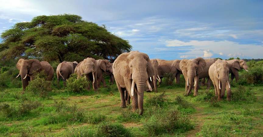
The vast amount of desert wildlife that calls these canyons home is surprising. In these serene canyonlands, bighorn sheep move with confidence on craggy cliffs; coyote, red fox and pronghorn prowl the grasses; and golden eagles keep an eye on everything from above.
And though these landscapes may look barren, plant lovers will find plenty to pique their interest. Spring is an especially good time to visit the Southwest, as a magnificent variety of desert verbena, lupine, Mexican poppies, globemallow, chuparosa, penstemon and daisies nurtured by the winter rain bloom in mass profusion and carpet the desert floor and slopes with vivid colors.
While this region is known as Red Rock Country, the canyon walls here can glow shades of gold, rose, rust and violet as the high desert light shifts throughout the day, bathing the rocks in ever-changing light and making it an ideal place for both amateur and professional photographers to practice their craft.

Photographing Bryce Canyon’s famous hoodoos © Jeremy Covert
There’s no shortage of spectacular places to visit in the Southwest to see unique rock formations and geologic wonders, but here are three of our favorites:
Grand Canyon
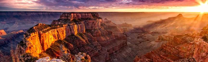
No round-up of geologic features of the Southwest would be complete without a mention of the Grand Canyon. A UNESCO World Heritage Site, it averages 4,000 feet deep for its entire 277 miles and is considered one of the best examples of arid-land erosion in the world. The canyon is 6,000 feet deep at its deepest point and 18 miles wide at its widest, and it tells one of the world’s greatest geologic stories. Its features allow scientists to piece together its history, starting at the bottom of the canyon and moving forward in time as you get closer to the rim.

Geology of the Grand Canyon
The story starts with the formation of the igneous and metamorphic rocks of the inner gorge. Stratigraphy is the study of the rock layering and in the Grand Canyon, there are clear horizontal layers of different rocks that provide information about where, when and how they were deposited, long before the canyon was even carved. The oldest rock in the Grand Canyon, known as the Elves Chasm Gneiss, is located deep in the canyon’s depths as part of the Vishnu Basement Rocks and comes in at an ancient 1.84 billion years old. The youngest of the Grand Canyon’s rock layers, the Kaibab Formation, forms the rims of the canyon and is only 270 million years old—but for perspective, that’s still older than dinosaurs!
Around 70 million years ago and again 30 million years ago, the whole region was uplifted through plate tectonic action, resulting in the Colorado Plateau. The canyon itself is geologically young, having been formed in the last 6 million years as the Colorado River started to carve its way downward. Further erosion by tributary streams led to the canyon’s widening. Even younger deposits, including ice age fossils in caves, 1,000 year-old lava flows in the western canyon, and recently deposited debris flows, bring the Grand Canyon’s geologic record up to the present. Even today, these forces are still hard at work deepening and widening the Grand Canyon.
Grand Canyon Plants and Animals
At higher elevations there is vegetation like ponderosa and pinyon pines, sagebrush scrub and pinyon-juniper woodlands. Gray fox, mule deer, bighorn sheep and rock squirrels all make their homes on the South Rim, while Kaibob squirrels, mountain lions and northern goshawks are primarily found on the North Rim.
With one of the clearest exposures of the rock record and such a long, diverse geologic history, the Grand Canyon is a perfect place to experience a sense of geologic or “deep” time. Join us on our Grand Canyon, Bryce & Zion trip to feel for yourself what it’s like to be overcome by wonder at your own tiny instant in geological history.
Bryce Canyon
You may be surprised to learn that the main thing to see in a place called Bryce Canyon isn’t actually a canyon. Located in the High Plateaus region of the Colorado Plateau in Utah, Bryce Canyon’s elevation, erosion, climate and rock type are all elements that create fantastically surreal rock spires called hoodoos that can rise hundreds of feet into the sky.

Bryce Canyon hoodoos © Jeremy Covert
History of Bryce Canyon’s Hoodoos
We know that people have been in the Colorado Plateau region for about 12,000 years, but only a handful of fragments of worked stone with Anasazi and Fremont influences tell of their presence near Bryce Canyon. Paiutes lived in the region when Euro-Americans arrived in southern Utah and explained the colorful hoodoos as “Legend People” who were turned to stone by Coyote.
Present-day scientists believe that the forces of water, ice and gravity (not wind) are responsible for the unique shapes in Bryce Canyon. These three forces—coupled with the differential erosion of the Claron Formation—produce a different morphology than that of any other area in the world.
The formation of Bryce Canyon and its hoodoos required three steps: the deposition of rocks, uplift of the land, and weathering and erosion.
The Cretaceous Period began about 144 million years ago and lasted until approximately 63 million years ago. For 60 million years, a great seaway extended northwestward into this area, depositing sediments of varying thickness and composition as it repeatedly invaded, retreated and then re-invaded the region. It left in its wake sediments thousands of feet thick—remnants that form the oldest, lowest, gray-brown rocks at Bryce Canyon.
In the Tertiary Period, between 66 and 40 million years ago, highlands to the west eroded into shallow, broad basins. Iron-rich, limy sediments were deposited in the beds of lakes and streams. These became the red rocks of the Claron Formation, from which the hoodoos are carved and for which the Pink Cliffs are named.
Then, 10 to 15 million years ago, the Paunsaugunt Plateau was lifted by the Colorado Plateau. Breaks (referred to as joints) formed in the plateau during the uplift. These joints allowed water to flow into the rock, where erosion widened them into rivulets and gullies. Over time, deep slot canyons formed in the sides of the plateau.
A Bird’s-eye View
The landscape of Bryce Canyon makes you feel as if you’ve stumbled upon another world. Its pink pinnacles, limestone formations and natural amphitheaters contrast with red rock walls that create deep channels throughout the park. Trails along the rock walls lead to tranquil recesses, perfect spots to appreciate the park’s diversity of birdlife. More than 175 different species of birds have been recorded as frequenting Bryce Canyon National Park, including golden eagles, chickadees, nuthatches and ravens.
But the birds aren’t the only ones able to enjoy the view from above. A special highlight that our Grand Canyon, Bryce & Zion guests love is getting a rare aerial perspective on the forest of pink sandstone hoodoos by way of a memorable helicopter flightseeing excursion.
Zion
Early Mormon pioneers gave Zion its name. They thought this place was so beautiful it evoked images for them of the biblical Promised Land. Many would say that Zion Canyon, formed by the North Fork of the Virgin River, is the most visually spectacular canyon in the region. The South Fork also forms a deep gorge (Parunuweap Canyon), and both branches have many other tributaries that form the slot canyons that Zion is famous for.

Geology of Zion: Sea and Sand Dunes to Sun-drenched Canyons
Zion National Park was once both a saltwater sea and a desert of towering sand dunes 240 million years ago. The sand dunes became what are now the breathtaking 2,000 foot cliffs of Zion National Park when movements in the earth’s crust caused the world’s largest sand dunes to sink below sea level. This allowed the sand to mix with minerals and calcium carbonate from the shells of sea animals to form sandstone. The earth’s movement then caused the land to uplift and drain the sea away, and rivers began to carve the sandstone, forming the deep canyons now found in Zion National Park.
Most slot canyons are remote, hidden and difficult to reach and explore, but the challenge only adds to the appeal of visiting them. The canyons tend to be dry for most of the year, but during the late summer months they receive occasional flash floods of great force carrying logs, stones and other debris. These floods have been cutting through the relatively soft orange and red Navajo sandstone for millions of years, creating an impressive array of colorful rock shapes and forms.
When sunlight shines down and reflects along the narrow canyon walls, the shadows and colors change constantly as the sun moves. The canyons often have wonderful pools and waterfalls and narrow channels, which make them even more fun to explore.
Plants and Animals of Zion
In the spring and early summer, wildflowers such as wild snapdragon, sacred datura, Indian paintbrush and sunflowers proliferate in the meadows. In the hotter, drier regions of the park, cactus, yucca and sagebrush are found. Trees such as cottonwoods, velvet ash and box elder grow along rivers and streams, while piñon pines and juniper cover the sunny slopes and ponderosa pine, aspens and fir trees happily grow at higher altitudes. Dripping springs uncover “hanging gardens” where ferns and grasses grow.
As for birds, everything from hummingbirds to California condors and Peregrine falcons can be found here. Our expert guides know the secret spots where we can see them, avoiding the swarms of tourists that flock to the park’s most crowded locations.
How Climate Change Threatens Our Canyonlands
The canyons of the American Southwest are a special part of the U.S. landscape. Unfortunately, these desert ecosystems are threatened by climate change. The Southwest is already the hottest and driest region in the U.S., and hotter temps and more frequent and intense droughts have amped up the intensity and frequency of wildfires. The region’s rich diversity of plant and animal species are also becoming increasingly stressed due to the area’s warming climate. Snowpack and streamflow amounts are projected to decline in parts of the Southwest, decreasing surface water supply reliability.
WWF is doing its part to help preserve free-flowing rivers by stopping dams and reconnecting rivers through dam removal, strengthening and promoting laws that protect rivers, and encouraging leaders at the local level to make eco-minded decisions about water management. Since 2003, Nat Hab has partnered with WWF to help promote their conservation mission. By experiencing the canyons of the Southwest with us on our Grand Canyon, Bryce & Zion tour, you participate in sustainable travel that supports the protection of nature, wildlife and local communities.


