If the caves near Lascaux, France, are any indication, it seems that our kind has been interested in depicting the directions for how to get from here to there ever since 13,500 B.C., when a Cro-Magnon decided to paint an animal migration route on his stony walls.
And ever since that time, we’ve regarded maps, for the most part, as “factual” tools. After the Greek philosopher Anaximander of Miletus drew the first global map in 550 B.C., our earliest cartographers were thought of as the knowledge-holders of the world, depicting all we knew of land and sea.
As new facts came to light, the maps were changed. In 1290 A.D., for example, the Hereford Mappa Mundi put Jerusalem at the center of the world. And in 1507, the word America started making its first appearances on maps: Martin Waldseemüller published the Universalis Cosmographia and named the land after Italian explorer and cartographer Amerigo Vespucci.
Today, there’s a wide variety in types of maps, including astronomical, climate, politics, economic activity, natural resources, navigation, politics and topography.
An obsession with quantification
Today, with so much data at your fingertips, you can access a map for almost any purpose: climate, topography, politics, economic activity, natural resources, physical relief or roads, to name just a few. There are satellite maps, lake-depth maps, elevation maps and contour maps. The urge to quantify and display our mastery and knowledge over the landscape is insatiable. For just one small spot on the planet—a forest, for instance—you can get a map of ski trails, a map of snowmobile trails, a map showing the forest’s composition of commercial tree species or a map that depicts the number of white-tailed deer per acre.
There’s an intriguing tale about one map that went a bit too far in its quest to factually quantify the land. In his one-paragraph, short story titled On Exactitude in Science published in 1946, Jorge Luis Borges wrote about an empire in which the art of cartography had attained such perfection “that the map of a single Province occupied the entirety of a City.” Over time, even that accuracy was no longer satisfactory. So the cartographer’s guild created a map of the empire “whose size was that of the Empire, and which coincided point for point with it.” With the scale of a mile to a mile, the map was, of course, unusable and unwieldy. It was decided that it should be “delivered up to the Inclemencies of Sun and Winters. In the Deserts of the West, still today, there are Tattered Ruins of that Map, inhabited by Animals and Beggars.”
A story map
The story points up the fact that maps, by nature, cannot be exact replicas of what’s in the real world, but only imperfect facsimiles. Maps reflect their makers—just what is deemed important by that particular person.
I prefer this notion that a map says more about the people and culture that made it than it does of the world out there. The Inuit have a portfolio of sky maps and cloud atlases. These charts of aerial moods allow them to infer the quality of the ice beneath the clouds, as well as predict the weather. The Koyukon people of northwest interior Alaska use quite a different form for their maps: intricate stories. According to anthropologist Richard Nelson, who has lived closely with the Koyukon, this is “narration by navigation.” Their stories are: “… filled with networks of paths, names and associations. People know every feature of the landscape in minute detail. The lakes, river bends, hills and creeks are named and imbued with personal and cultural meaning.”
Uncharted territory
With all of our maps and map types, it’s hard to find any uncharted areas on the globe anymore. But adventure travelers still seek such places out, and they are probably the ones who come closest to finding them. At least the maps of their worlds hold big, empty, color blocks of green, without the blue and red lines of highways.
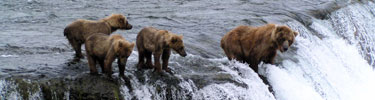
There’s a map of the Great Bear Rain Forest in northwest Canada that looks like that. It’s the one I’ve drawn on the wall of my own mind. Flying over that region, I saw vast expanses of trees, clouded mountains, and blue-water coves and inlets. The Kermode bear, or “spirit bear” lives there and only there, and it is believed that just 400 of them are left in the world. I’ve imagined a map of that complicated land of rivers, streams, islets, ponds and pockets. It shows where whales sing, wolves play and white black bears can live in peace.
It’s a simple map: a square of green interrupted with dots of blue and white. Nothing else. Because what lives in those blank spots is hope.
Here’s to finding your true places and natural habitats,
A multiple award-winning author and writer specializing in nature-travel topics and environmental issues, Candice has traveled around the world, from the Arctic Circle to Antarctica, and from New Zealand to Scotland's far northern, remote regions. Her assignments have been equally diverse, from covering Alaska’s Yukon Quest dogsled race to writing a history of the Galapagos Islands to describing and photographing the national snow-sculpting competition in her former home state of Wisconsin.
In addition to being a five-time book author, Candice's work has also appeared in several national and international publications, such as "The Huffington Post" and "Outside Magazine Online."
There’s a great idea for Charlie Kaufman’s next movie! I love that the map ended up “inhabited by Animals and Beggars.”
(Originally posted on LinkedIn)
Maps were once an inspiration to take one step further to discover how to build on the Map that is currently being used. . . as Captain Jack would say “more of a guideline than a rule”.
today, we are so fixated on knowing, that we forget to wonder and learn?
Maps are an inspiration to learn more and to explore.
Joel
The best thing about using maps is you never have to listen to suggestions to stop at a gas station and ask directions.
I miss the days when maps still notated “here be dragons.”
Recently, someone published a “crime as elevation” map of San Francisco. I suppose that would have to be a three-dimensional map.
There are real places that aren’t on maps, but I’ve always had a soft spot for false places that are.